Normally at this time of year, people would be starting to emerge from their winter “hibernation” habits and would start spending more time outdoors in local parks, exploring city neighborhoods and maybe even hitting the highways for a road trip or two. This year, with COVID-19 lockdowns, we are forced to stay close to home.
Google has some excellent tools for bringing the world, or your own city, into your living room and these tools can be great opportunities for family activities. They are also fantastic tools for enriching remote learning and creating interactive experiences.
Here in Israel, we are slowly emerging from lockdown. At this time of year, families tend to go on hikes and picnics in national parks, activities which have not yet re-opened. So at The Beit Issie Shapiro School for Special Education, we explored the country from the classroom.

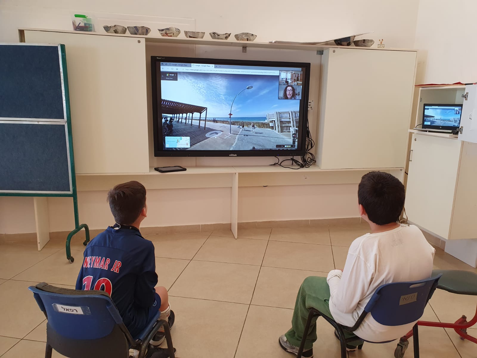
Students taking part in a Google Maps activity, with their OT on Zoom.
This activity was led by the occupational therapists, who were still working from home, and led the activity for students remotely. We created a communication board for the students so they could choose where they wanted to explore, complete with seek-and-find tasks for the sites they would visit. We connected on Zoom, and as each student chose a location, we travelled there together on Google Maps and explored the area. It was great fun! This can easily be adapted to explore any city or even the students’ own streets!
A few tips for using Google Maps for this activity (for those who may not be too familiar with it):
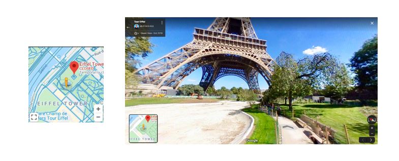
1. On a computer – once you get to your desired location you will typically see a screen like this:

Screenshot of Google Maps streetview and navigation tools
Hovering your mouse on the small map in the bottom left-hand corner will reveal blue lines and dots, basically paths and locations, that you can drag the yellow man to, for a street-view look of that location.
To get a 360-degree perspective, drag the screen or click the compass on the right-hand side. Moving a mouse on the screen reveals an arrow (seen on the footpath in the photo above) in the image. Clicking on this arrow allows you to navigate through the map and move to other locations.
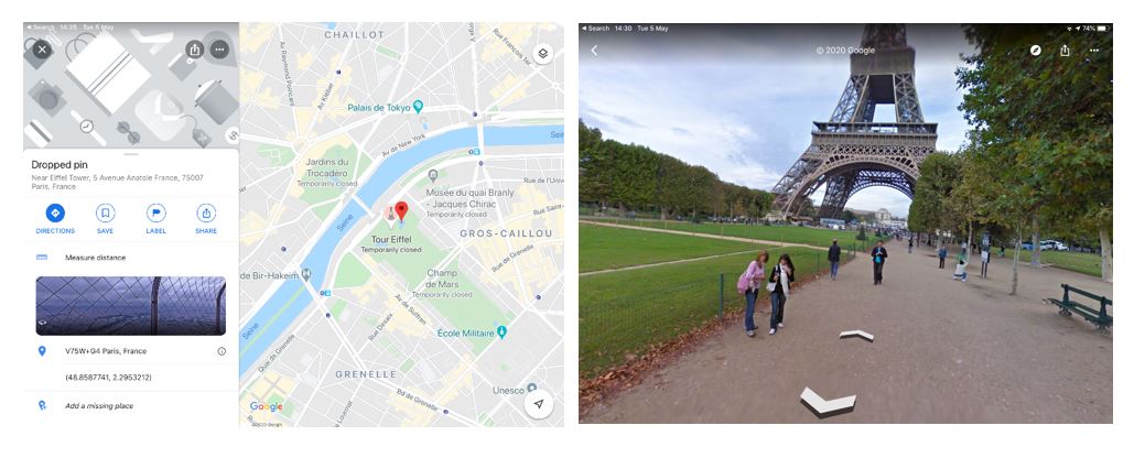
2. On an iPad – Search for a location in the Google Maps app. Following the example above, a search for the Eiffel Tower brings up a map of the general area. Touch the map to “drop” a red pin on the map. This should open a window on the left of options for your exact location.
Touching on the photo in the menu will open a street-view of that location that you can navigate using the arrows of the compass icon in the top right.

Screenshots of iOS version of Google Maps
3. For more virtual exploring, here are a few links to recent articles with collections of amazing virtual tours from around the world, including underwater adventures!
https://www.townandcountrymag.com/leisure/arts-and-culture/a31900863/best-virtual-tours/
https://www.weareteachers.com/best-virtual-field-trips/
Digital tours are also great opportunities for playing “I Spy” type games. Play spontaneously, or create a list of things to look for in each location.
Enjoy your travels, and be sure to send us a postcard of your adventures! 😉


Nice!!. Majority of us doesn’t know some of familiar features and how can we explore them better.
Augmented Reality(AR) one among them, which will be great fun for children’s at this time of lockdown.